
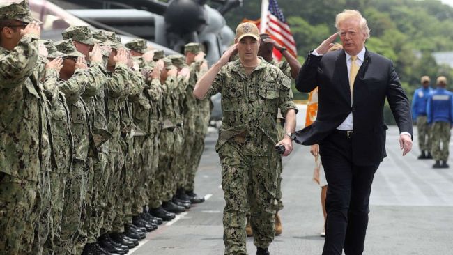
While Democrats clutch pearls and foreign ministries issue the same tired statements, President Donald Trump spent Labor Day doing what he does better than any president in modern history: he set the agenda, forced every network to react to him, and reminded the hemisphere who still writes the story.
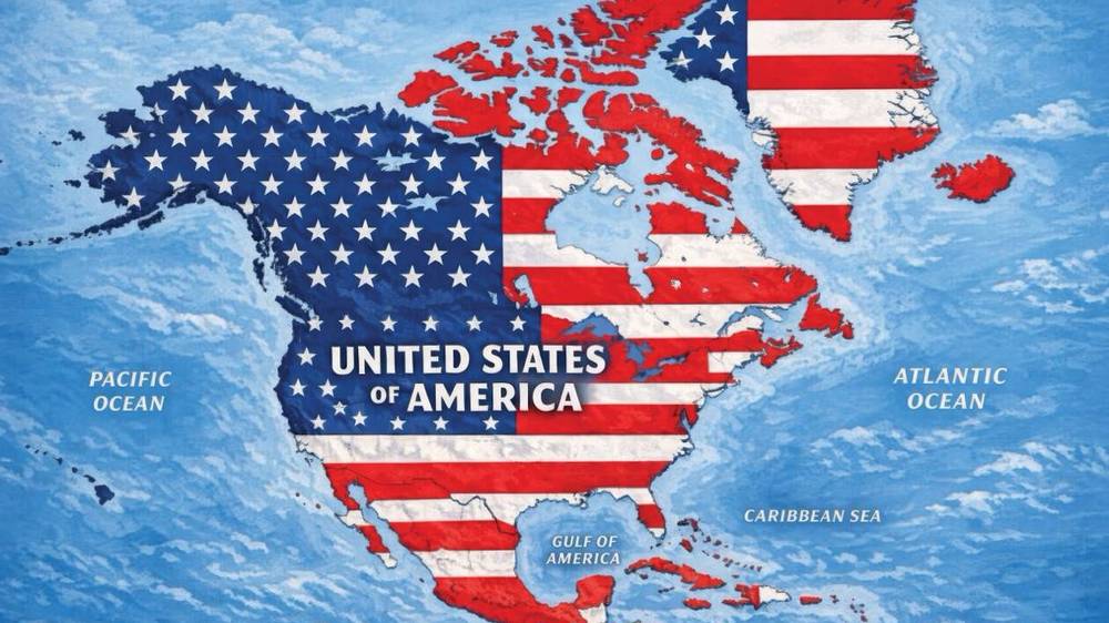
The Newsmax report is straightforward. Trump expanded his geographic rebranding campaign from renaming American places to posting AI-generated maps that drape the Stars and Stripes over Canada, Mexico, Greenland, Cuba, Guatemala and other neighboring territory. One image labels the whole continental mass “UNITED STATES OF AMERICA.” Another batch of posts X’d out “Mexico” on New Mexico and stamped “New America” across the state. No executive order. No invasion fleet. Just images — and the entire political class lost its mind.
That’s not madness. That’s narrative dominance.
He Posts. They Panic. He Wins.
The left and the foreign press keep making the same mistake. They treat a Truth Social graphic like a declaration of war. Trump treats it like a weapon of attention.
He posted with little or no caption. That is the point. When the president of the United States drops a flag-draped map of North America and walks away, every editor, every diplomat, and every Democratic press shop has to fill the silence. They fill it with the word “annexation.” They fill it with “imperialism.” They fill it with lectures about international law. And every one of those reactions is a free advertisement for Trump’s frame: America is strong again, America is not apologizing, and America First is not a slogan — it is a posture.
Look at the sequence. First he ordered the federal government to say Gulf of America. Then he signed an order turning Lake Ontario into Lake America on U.S. maps. Then he floated New America for New Mexico. Then he posted the continental flag map. Each step is bigger. Each step is cheaper than a speech. Each step makes Mark Carney, Michelle Lujan Grisham, and a chorus of European officials respond to his vocabulary instead of theirs.
That is how you control a narrative in 2026. You do not beg cable bookers. You publish the picture. They write the 800-word freakout. You go play golf.

Trump posts map suggesting New Mexico be renamed ‘New America’
New Mexico Democrats insisted the name “isn’t up for debate.” Fine. The Constitution still requires the state to change its own name. Trump never claimed otherwise. He also never needed a statute to make “New America” the phrase every New Mexican heard on Labor Day weekend. The governor had to answer a meme. That is the power imbalance.
This Is Not “Coloring on Maps.” It Is America First Geography
The media wants you to see a senile emperor doodling on a globe. Conservatives should see something older and more serious: a president who refuses to treat the Western Hemisphere as a museum of other people’s borders.
Greenland is not a punchline. It is the largest island on Earth sitting astride the Arctic approaches, packed with rare earths and watched by China and Russia. Trump has said for years the United States needs it for national security. Denmark cannot defend it. Europe will not. Posting it under the American flag is a reminder that strategic real estate does not stay ownerless forever.
Canada-as-51st-state talk lands because the joke has a kernel of truth. Canada lives in America’s security shadow, sells into America’s market, and then lectures Washington about manners. Trump’s tariffs and “Lake America” rename are the grown-up version of the same point: stop free-riding and stop pretending the relationship is equal. Mexico’s cartels, migration chaos, and the absurdity of a U.S. state still branded “New Mexico” give the “New America” gag its bite.
None of that requires a formal annexation bill tomorrow. It requires a president willing to say the quiet part with a picture.

Trump focuses on $400M ballroom as critics say he ignores voter concerns
Why Trump Still Owns the Narrative
Three reasons this works when other politicians’ stunts die in an hour.
1. He never explains the joke.
The map went up with no speech, no fact sheet, no “what I really meant.” Ambiguity is rocket fuel. Allies wonder how serious he is. Adversaries have to plan for the serious version. The press has to speculate. Speculation is coverage. Coverage is control.
2. He attaches pictures to real policy.
Gulf of America is already in the federal names system and on U.S. Google and Apple Maps. Lake America is on the books. Greenland has been a live acquisition demand, not a late-night bit. The maps feel dangerous because they sit on top of actual executive action, not instead of it.
3. The other side has no counter-image.
What is the Democratic visual? A press release. A concerned governor on X. A European statement about “international law.” That is beige. Trump’s map is red, white, and blue across an entire continent. In the attention economy, beige loses.
The same outlets that spent a decade calling Trump a threat to democracy now spend Labor Day explaining his cartography. They cannot help themselves. Every “this is unacceptable” quote from a Democrat is another hour of Trump’s map on screen.
Watch the Coverage — Then Watch Who Sets It
Newsmax carried the facts without the faintest. For video of the surrounding fight — Canadian officials bristling, New Mexico Democrats scolding, and the president’s posting pace — start here:
- Newsmax’s original report and live coverage: Trump Expands Map Posts to Envision US Annexing Neighboring Countries
- Broadcast wrap of the map and the “U.S. Territory” frame: YouTube — Trump’s 2026 map message
Watch who is reacting and who is originating. That is the whole lesson.
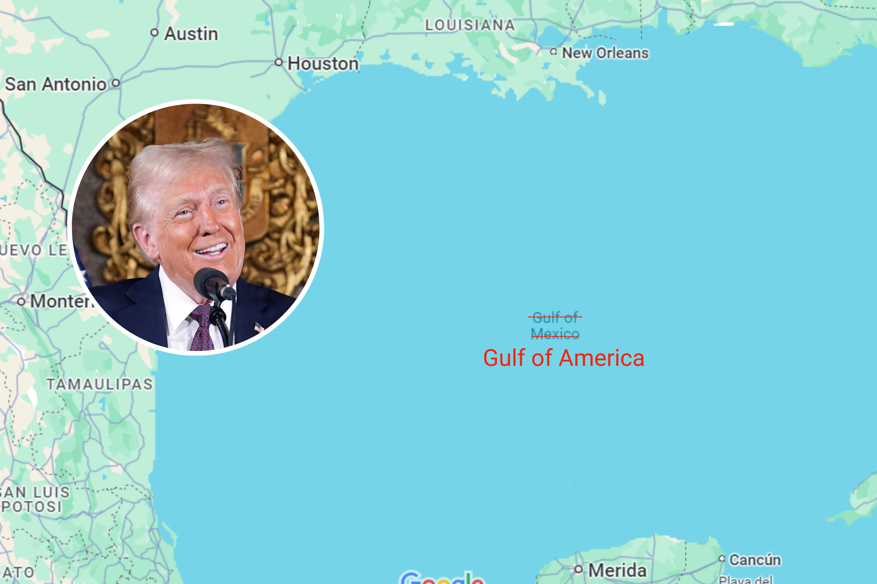
Donald Trump floats changing name of Gulf of Mexico: ‘Gulf of America’ – Newsweek
The Map Is the Message
America spent years being told that strength was embarrassing, that borders were optional, and that the proper posture toward neighbors was apology. Trump’s Labor Day maps are the opposite posture: we name our waters, we name our states, and we are not ashamed to put our flag on the picture of the neighborhood we actually police.
Is every pixel a treaty? No. Newsmax itself noted the images do not change borders and are not a formal annexation plan. That distinction is exactly why the freakout is so useful. If it were a legal filing, lawyers would argue. Because it is a picture, the country feels it.
Presidents who wait for permission never redraw anything. Presidents who post the map first force everyone else to argue on their terrain.
That is why Donald Trump still controls the narrative. He does not ask the media what America looks like. He shows them — and then lets them scream about it until the next post.